
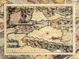
Bay of Kotor (N-57)
€15,92Map of the Bay of Kotor, 1688, Vincenzo Maria Coronelli
It comes with a cardboard sleeve that is included in the price on the web shop.
Showing all 8 results
Map of the Bay of Kotor, 1688, Vincenzo Maria Coronelli
It comes with a cardboard sleeve that is included in the price on the web shop.
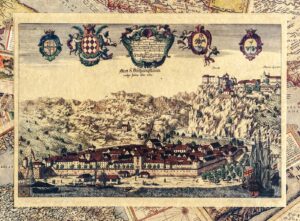
Painted depiction of Rijeka from 1689. years. Author: Johann Weichard Valvasor
Engraved by: Andreas Trost.
It comes with a cardboard sleeve that is included in the price on the web shop.
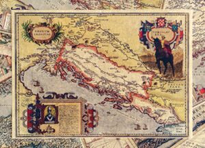
Croatia in the time of King Tomislav.
It comes with a cardboard sleeve that is included in the price on the web shop.
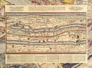
Part of Peutinger’s map, it shows Istria and Rome. It contains the original description from a replica made by Ortelius, published in 1598.
It comes with a cardboard sleeve that is included in the price on the web shop.
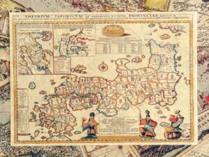
Map of Japan, Engelbert Kaempfer, 1727
It comes with a cardboard sleeve that is included in the price on the web shop.
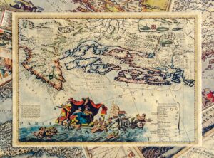
Colored depiction of Kvarner from 17. century Author: Vincenzo Coronelli, 1696, Venice.
It comes with a cardboard sleeve that is included in the price on the web shop.
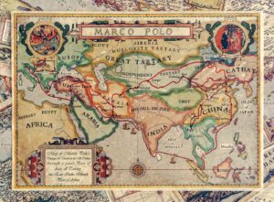
Old map with the travels of Marco Polo, Author: Tomislav Jeličić, Croatia, Selce, 2015.
It comes with a cardboard sleeve that is included in the price on the web shop.
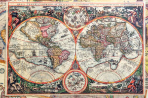
Joannes Baptista, Antwerp, 1596. The second oldest printed map of the world.
A replica of the old ticket comes with a cardboard sleeve that is included in the price on the web shop.
No products in the cart.